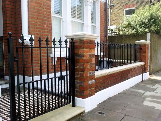
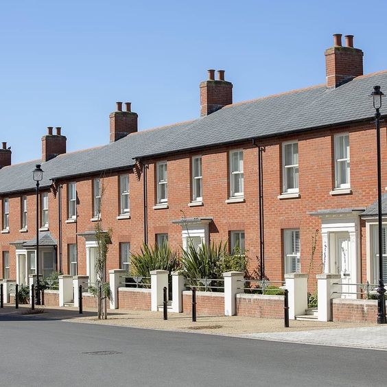
Built Form
Built formForm is the three-dimensional shape and modelling of buildings and the spaces they define. Buildings and spaces can take many forms, depending upon their: size and shape in plan; height; bulk – their volume; massing – how bulk is shaped into a form; building lines – the alignment of building frontages along a street; and relationship to the plot boundary – and whether they share party walls or not. In the case of spaces, their form is influenced by the buildings around them. More is the three dimensional pattern or arrangement of development blocks, streets, buildings and open spaces
Home > Design Guide > Built Form
Contents
B1. Compact Form of Development
>
B2. Built FormForm is the three-dimensional shape and modelling of buildings and the spaces they define. Buildings and spaces can take many forms, depending upon their: size and shape in plan; height; bulk – their volume; massing – how bulk is shaped into a form; building lines – the alignment of building frontages along a street; and relationship to the plot boundary – and whether they share party walls or not. In the case of spaces, their form is influenced by the buildings around them. More
>
Help with this page
2. Achieving sustainable development >
5. Delivering a sufficient supply of homes >
6. Building a strong, competitive economy >
7. Ensuring the vitality of town centres >
8. Promoting healthy and safe communities >
9. Promoting sustainable transport >
10. Supporting high quality communications infrastructure >
11. Making effective use of land >
12. Achieving well-designed places >
13. Protecting Green Belt land >
14. Meeting the challenge of climate change, flooding and coastal change >
15. Conserving & enhancing the natural environment >
Accessibility: The ability of people to move around an area and reach places and facilities, including older and disabled people, those with young children and those carrying luggage or shopping.
Compact form of development: Development that is planned with a relatively high residential density and an urban layout. Community facilitiesFacilities such as libraries, places of worship, halls for hire, youth space and training and meeting space. This list is not exhaustive and other uses can be included. More are closer to one another and their users, preserves more open landscape, and makes efficient use of land and resources.
Walkable: Local facilities are within walking distance, generally considered to be no more than a 10 minute walk (800m radius).
Destinations: Places or facilities that people want to visit. In a neighbourhood these may be transport hubs, open spaces, local services such as schools, shops, healthcare or community facilitiesFacilities such as libraries, places of worship, halls for hire, youth space and training and meeting space. This list is not exhaustive and other uses can be included. More.
B1. Compact Form of Development
A compact form of development is more likely to accommodate enough people to support shops, local facilities and viable public transport, maximise social interaction in a local area, and make it feel a safe, lively and attractive place. In this way, it may help to promote active travelMaking journeys by physically active means like walking, wheeling or cycling, rather than motor vehicle. More to local facilities and services, so reducing dependence on the private car.
What is meant by compact will vary according to area typeParts of the local area that share common features and characteristics. Common rules and parameters can then be applied to each area type. More and context. A design code may define an appropriate measure of compactness for new development in relation to an area typeParts of the local area that share common features and characteristics. Common rules and parameters can then be applied to each area type. More.
B1.1 Density
Residential Density
Residential density is easiest assessed by calculating the number of dwellings per hectare.
Non-Residential and Mixed Use Density
Plot ratio

This is the ratio between site area and the total building floor area. It is calculated by dividing the total gross floor area of the building by the area of the plot.
Active fronts provide informal surveillance opportunities, improving the safety of an area and creating vitality through the presence and interaction of people.
The following plot ratios are recommended in these site contextsThe context includes the immediate surroundings of the site, the neighbourhood in which it sits and the wider setting. The context may include the physical surroundings of topography, movement patterns and infrastructure, built form and uses. An understanding of the context, history and character of an area must influence the siting and design of new development. More:
- Town Centres; greater than 2
- Urban Neighbourhoods; greater than 1
- Suburban; greater than 0.5.
Plot coverage

This is is the proportion of the site area occupied by buildings. It can be calculated by dividing the building footprint by the total plot area.
A good balance between density and the liveability of a building and its plot needs to be achieved. Larger building coverage allowance creates denser developments that can support local services. Lower building coverage provides more outdoor space for gardens or private parking.
The following plot coverage ranges are recommended in these site contextsThe context includes the immediate surroundings of the site, the neighbourhood in which it sits and the wider setting. The context may include the physical surroundings of topography, movement patterns and infrastructure, built form and uses. An understanding of the context, history and character of an area must influence the siting and design of new development. More:
- Town Centres; 75 – 100%
- Urban Neighbourhoods; 50-75%
- Suburban; 25-50%
B1.2 Whether Buildings Join

The diagram shows the amount of space required for different options of attached, semi-detached and detached housing. Housing that is detached with land either side requires 75% more land then more compact terraced housing.
Town centres; Buildings should be allowed to join on either side and to the rear.
Urban neighbourhoods; Buildings should be allowed to join on either side.
Suburbs or rural areas; In this context, the space to side of buildings for gardens or parking is appropriate. Buildings can be attached, semi-detached or detached.
When buildings join to neighbouring buildings the form of development is more compact than when they do not. Freestanding buildings generally occupy wider plots, which affects both density and compactness.
Georgian terraced streets in London provide a high density and attractive built formForm is the three-dimensional shape and modelling of buildings and the spaces they define. Buildings and spaces can take many forms, depending upon their: size and shape in plan; height; bulk – their volume; massing – how bulk is shaped into a form; building lines – the alignment of building frontages along a street; and relationship to the plot boundary – and whether they share party walls or not. In the case of spaces, their form is influenced by the buildings around them. More.
B1.3 Building Types and Forms
Window propotion

The diagram demonstrates that visually interesting streets can be achieved through repetition and structure of window proportions.
Repeated proportions ensure coherence to a street, even if other building elements such as colour and height vary along the street. This allows for both structure and informality in balance.
Repetition of window proportions should generally take place within a singular street. In urban streets, aim for around 50-100% of buildings along a street to include a repeated proportion. Where an existing window proportion exists on street, aim to replicate it in new infill projects.
Portobello Square exhibits a variety of window proportions that repeat on both sides of the street
Repeated window proportion on rear mews street.
image courtesy: PRP Architects LLP
B2. Built Form
61. Built form is the three-dimensional pattern or arrangement of development blocks, streets, buildings and open spaces. It is the interrelationship between all these elements that creates an attractive place to live, work and visit, rather than their individual characteristics. Together they create the built environment and contribute to its characterCharacter includes all of the elements that go to make a place, how it looks and feels, its geography and landscape, its noises and smells, activity, people and businesses. This character should be understood as a starting point for all development. Character can be understood at three levels; the area type in which the site sits, its surroundings and the features of the site. More and sense of place.
62. It is relevant to city and town centres, suburbs, villages and rural settlements. It creates a coherent framework that forms a basis for the design of individual developments within a place.
63. Well-designed places have:
- compact forms of development that are walkable, contributing positively to well-being and placemakingRecognising the distinctiveness of individual locations in plans, policies and proposals, and responding accordingly. More;
- accessible local public transport, services and facilities, to ensure sustainable development;
- recognisable streets and other spaces with their edges defined by buildings, making it easy for anyone to find their way around, and promoting safety and accessibility; and
- memorable features or groupings of buildings, spaces, uses or activities that create a sense of placeA sense of place is the unique collection of qualities and characteristics that makes one town or development different to another. It lends meaning or attachment to a development or place, transforming it into a home, a neighbourhood, or a community. A sense of place is also what makes our physical surroundings worth caring about. More, promoting inclusion and cohesion.
B2.1 Blocks

The diagram demonstrates that visually interesting streets can be achieved through repetition and structure of window proportions.
Repeated proportions ensure coherence to a street, even if other building elements such as colour and height vary along the street. This allows for both structure and informality in balance.
Repetition of window proportions should generally take place within a singular street. In urban streets, aim for around 50-100% of buildings along a street to include a repeated proportion. Where an existing window proportion exists on street, aim to replicate it in new infill projects.
Portobello Square exhibits a variety of window proportions that repeat on both sides of the street
Repeated window proportion on rear mews street.
image courtesy: PRP Architects LLP
Types of Blocks
The diagram demonstrates that visually interesting streets can be achieved through repetition and structure of window proportions.
Repeated proportions ensure coherence to a street, even if other building elements such as colour and height vary along the street. This allows for both structure and informality in balance.
Repetition of window proportions should generally take place within a singular street. In urban streets, aim for around 50-100% of buildings along a street to include a repeated proportion. Where an existing window proportion exists on street, aim to replicate it in new infill projects.
Portobello Square exhibits a variety of window proportions that repeat on both sides of the street
Repeated window proportion on rear mews street.
image courtesy: PRP Architects LLP
B2.2 Building Line
U1. Active Ground Floor Uses

The image shows an active street with good balance of ground floor uses that activate the street.
Active fronts provide informal surveillance opportunities, improving the safety of an area and creating vitality through the presence and interaction of people.
Ground floors should allow for a variety of active uses that could include:
- shops
- cafes, restaurants or bars
- studios and workshops
- office foyers
- community services
- communal residential facilities
- building entrances
Here in Camden Town is good example
U2. Front set backs
Suburban context


Urban context


The set back of a building relates to the distance between the private property boundary and the front elevation of building. Typically in an urban context, mixed useA well-integrated mix of different land uses which may include retail, employment, leisure and other service uses with decent homes of different types and tenures to support a range of household sizes, ages and incomes. More buildings will be built to the boundary line as will have active ground floor uses that require access directly from street. In residential settings where there is requirement for privacy at ground floor there will be a set back from street edge.
The amount of set back is important as it impacts the level of interaction and activity a building can provide at the human scaleThe use within development of elements which relate well in size to an individual human being and their assembly in a way which makes people feel comfortable rather than overwhelmed. More, i.e. at ground floor eye level. In a single use residential building, then a set back is considered important for privacy reasons.
The extent to how much a building should be set back will depend on the presence of any existing building line and the density of the contextThe context includes the immediate surroundings of the site, the neighbourhood in which it sits and the wider setting. The context may include the physical surroundings of topography, movement patterns and infrastructure, built form and uses. An understanding of the context, history and character of an area must influence the siting and design of new development. More. The more suburban and rural the area, the more set back could be permissible. However, in all contextsThe context includes the immediate surroundings of the site, the neighbourhood in which it sits and the wider setting. The context may include the physical surroundings of topography, movement patterns and infrastructure, built form and uses. An understanding of the context, history and character of an area must influence the siting and design of new development. More a front set back for landscape is a positive use of land, especially in denser areas where greenery is limited.
Building Heights
The diagram demonstrates that visually interesting streets can be achieved through repetition and structure of window proportions.
Repeated proportions ensure coherence to a street, even if other building elements such as colour and height vary along the street. This allows for both structure and informality in balance.
Repetition of window proportions should generally take place within a singular street. In urban streets, aim for around 50-100% of buildings along a street to include a repeated proportion. Where an existing window proportion exists on street, aim to replicate it in new infill projects.
Help
Lorem ipsum dolor sit amet, consectetur adipiscing elit. Ut elit tellus, luctus nec ullamcorper mattis, pulvinar dapibus leo.
Accessibility: The ability of people to move around an area and reach places and facilities, including older and disabled people, those with young children and those carrying luggage or shopping.
Compact form of development: Development that is planned with a relatively high residential density and an urban layout. Community facilities are closer to one another and their users, preserves more open landscape, and makes efficient use of land and resources.
Walkable: Local facilities are within walking distance, generally considered to be no more than a 10 minute walk (800m radius).
Destinations: Places or facilities that people want to visit. In a neighbourhood these may be transport hubs, open spaces, local services such as schools, shops, healthcare or community facilities.
National Planning Policy Framework
2. Achieving sustainable development
5. Delivering a sufficient supply of homes
6. Building a strong, competitive economy
7. Ensuring the vitality of town centres
8. Promoting healthy and safe communities
9. Promoting sustainable transport
10. Supporting high quality communications infrastructure
11. Making effective use of land
12. Achieving well-designed places
13. Protecting Green Belt land
14. Meeting the challenge of climate change, flooding and coastal change
15. Conserving and enhancing the natural environment
Useful References
National Planning Policy Framework
A Green Future: Our 25 Year Plan to Improve the Environment
Biodiversity 2020: A strategy for England’s wildlife and ecosystem services
BRE: Site layout planning for daylight and sunlight
Building with Nature Standards
Centre for Protection of National Infrastructure (CPNI) resources
Increasing Residential Density in Historic Environments
Protecting crowded places: design and technical issues
Spatial Planning for Health: An evidence resource for planning and designing healthier spaces
Technical Housing Standards – nationally described space standard
Trafford Council SPD5 Conservation Areas
Understanding Place: Historic Area Assessments
Biodiversity 2020: A strategy for England’s wildlife and ecosystem services >