Trafford's Places
Sale and surrounds
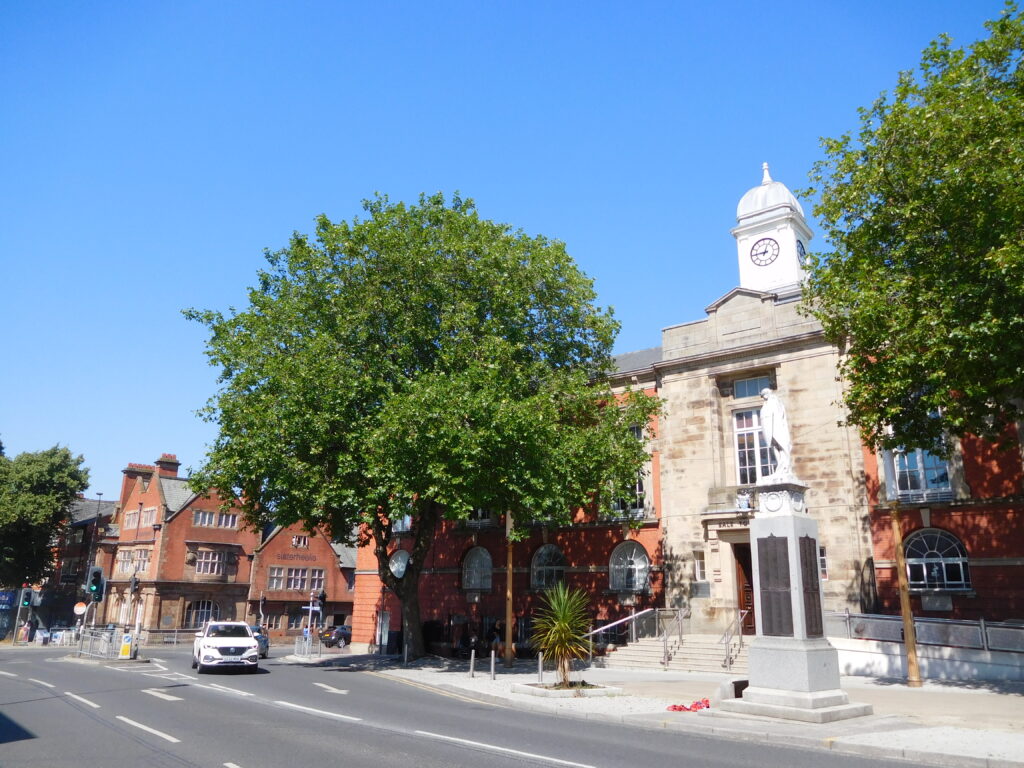
Sale and its surroundings form a residential suburb which grew around the introduction of the railway. It is bound to the north by the River Mersey and the M60, to the west by Carrington, and to the south by Timperley. Its vibrant town and village centres, central location and excellent transport links continue to make it a popular residential area.
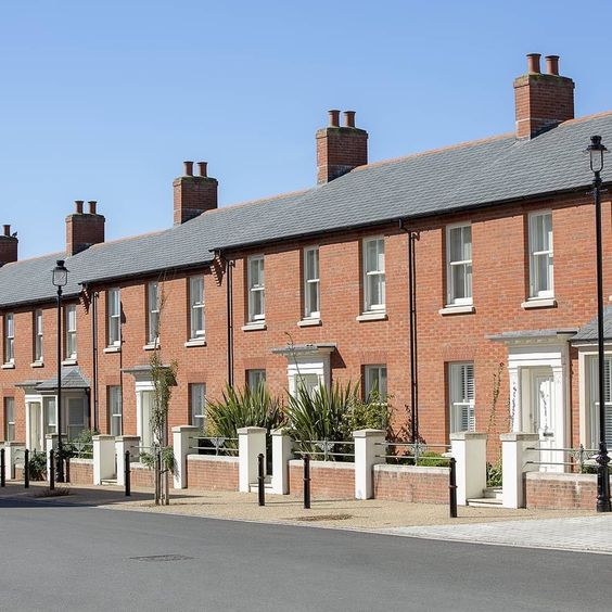
Sale town centre provides the central focus to the area, while Sale Moor and Ashton Upon Mersey local centres have a well-preserved village quality. The M60 Motorway, the A56, Metrolink and canal corridors pass through Sale, making it a well-connected place, with the opportunity to provide sustainable development with active pedestrian and cycle transport links, including along the Bridgewater Canal. Sale grew rapidly as a commuter town with the development of the Altrincham to Manchester Railway line in 1849. Many parts of Sale, including the central parts are best characterised by their well-preserved Victorian and Edwardian suburban qualities, leading to a generous spatial quality. Exceptional examples of this suburban style of architecture with decorative facades and roof detailsThe details of a building are the individual components and how they are put together. Some are a deliberate part of the appearance of a building, including doors, windows and their surrounds, porches, decorative features and ironmongery. Others are functional, although they can also contribute to the appearance of a building. These include lighting, flues and ventilation, gutters, pipes and other rainwater details. Detailing affects the appearance of a building or space and how it is experienced. It also affects how well it weathers and lasts over time. More, sit behind established stone boundary walls and hedges along tree lined streets.
Beyond the historic central areas, and those around Ashton upon Mersey, Sale Moor, and Brooklands Station, 20th century semi-detached housing estates make up the majority of the urban form, where the characterCharacter includes all of the elements that go to make a place, how it looks and feels, its geography and landscape, its noises and smells, activity, people and businesses. This character should be understood as a starting point for all development. Character can be understood at three levels; the area type in which the site sits, its surroundings and the features of the site. More remains green and suburban, with numerous parks providing space for recreation. The primary residential forms are Edwardian and Victorian terraces, semi-detached, and villa properties, together with extensive areas of inter-war semi-detached properties. The A56 corridor passes through the middle of Sale, which has provided impetus for commercial activity. This includes some notable examples of early 20th century Art Deco and early modernist style buildings.
Development Plan Documents
Brogdon Grove
Ashton Upon Mersey
Kings Ransom, Sale
Broad Rd, Sale
Ashton Hall
Evolution
1885-1903
1888-1913
1937-1961
1955-1961
Map
Aerial
1885-1903
1888-1913
1937-1961
1955-1961
Map
Aerial
Local Character Areas
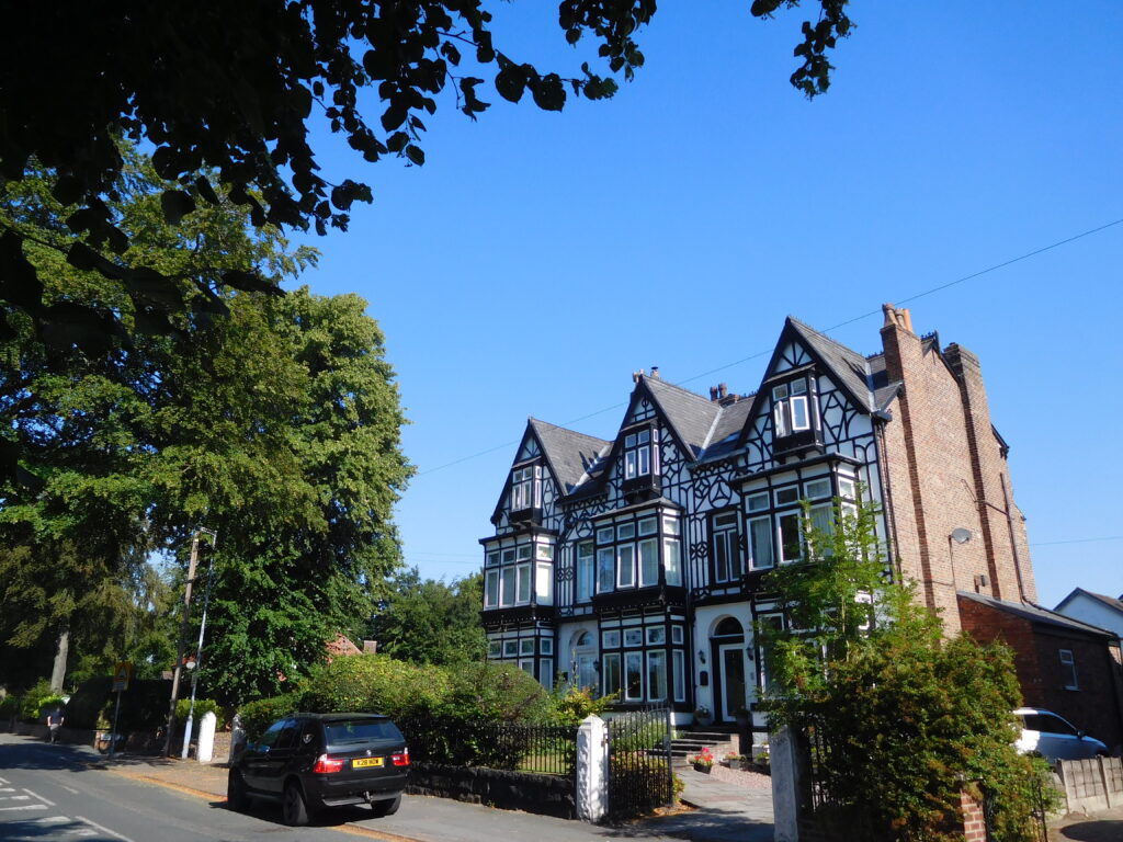
Ashton-upon-Mersey, linked ecclesiastically to Sale since the middle-ages, fields around Ashton-upon-Mersey were used for crop and cattle farming. The residential settlement grew up around Church Lane and Green Lane, and later around St Mary’s Church, and along Ashton Lane towards Sale town centre. This area is characterised by many fine examples of Victorian and Edwardian villas and semi-detached properties set behind stone and brick boundary walls with extensive tree cover.
Sale Moor, with the advent of the railway, given its proximity to the station, Sale Moor became the most expensive area in Sale, characterised by villa residences. These were often decorated with stained glass or different coloured bricks in an attempt to make them ‘mansions in miniature’ for the aspiring middle class. Examples can be seen along Northenden Road, Wardle Road and Derbyshire Road.
Brooklands, residential development grew around Brooklands Station, mansions were developed by Samuel Brooks along Brooklands Road. Other terraced, semi-detached and villa properties built in the Victorian and Edwardian style close to the station such as those around Marsland Road, Poplar Grove and South Grove still survive and lend the area an established, affluent characterCharacter includes all of the elements that go to make a place, how it looks and feels, its geography and landscape, its noises and smells, activity, people and businesses. This character should be understood as a starting point for all development. Character can be understood at three levels; the area type in which the site sits, its surroundings and the features of the site. More.
Sale East, Woodheys/Woodhouse Lane and Eastway, extensive areas of 20th century housing, typically semi-detached post war properties, with generous gardens set behind brick boundary walls.
Sale West, another extensive residential area characterised by a variety of estates, including Radburn style estates, dating from the 1970s, 1980s and 1990s. It forms the westernmost edge of Sale and borders the adjacent New Carrington allocation. Trafford Design Code Trafford’s Places
Sale
Sale Moor
Brooklands
Sale east
Ashton-Mersey
Woodhouses
Sale west
Sale
Sale Moor
Brooklands
Sale east
Ashton-Mersey
Woodhouses
Sale west
Place Specific Design Cues
Context dependent design cues should be taken from the best examples of properties that were built at the time these localities started to develop.
Please refer to the Common Housing Types in Trafford link for guidance on how to understand context. This includes a number of the cues set out below. Characteristics commonly found in Sale are set out below:
Notable buildings and landmarks – consider how these might inform new design.
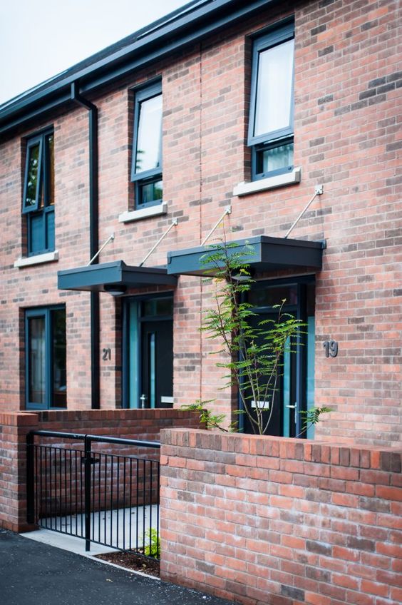
Built FormForm is the three-dimensional shape and modelling of buildings and the spaces they define. Buildings and spaces can take many forms, depending upon their: size and shape in plan; height; bulk – their volume; massing – how bulk is shaped into a form; building lines – the alignment of building frontages along a street; and relationship to the plot boundary – and whether they share party walls or not. In the case of spaces, their form is influenced by the buildings around them. More, Height, Roofscape – generally two-storey with dual pitched roofs.
Local building materials – almost exclusively red brick in stretcher, English Garden Wall or Flemish bond with sandstone detailingThe details of a building are the individual components and how they are put together. Some are a deliberate part of the appearance of a building, including doors, windows and their surrounds, porches, decorative features and ironmongery. Others are functional, although they can also contribute to the appearance of a building. These include lighting, flues and ventilation, gutters, pipes and other rainwater details. Detailing affects the appearance of a building or space and how it is experienced. It also affects how well it weathers and lasts over time. More, and blue slate or red clay tiled roofs.
Façade composition – generally bay windows at one and two storeys, with vertically proportioned sash windows.
Architectural detailingThe details of a building are the individual components and how they are put together. Some are a deliberate part of the appearance of a building, including doors, windows and their surrounds, porches, decorative features and ironmongery. Others are functional, although they can also contribute to the appearance of a building. These include lighting, flues and ventilation, gutters, pipes and other rainwater details. Detailing affects the appearance of a building or space and how it is experienced. It also affects how well it weathers and lasts over time. More – particularly prevalent around doorways, windows, bays and eaves. Mock Tudor panelling or planted timber detail and roughcast render to first floor. Recessed windows, doors and open porches.
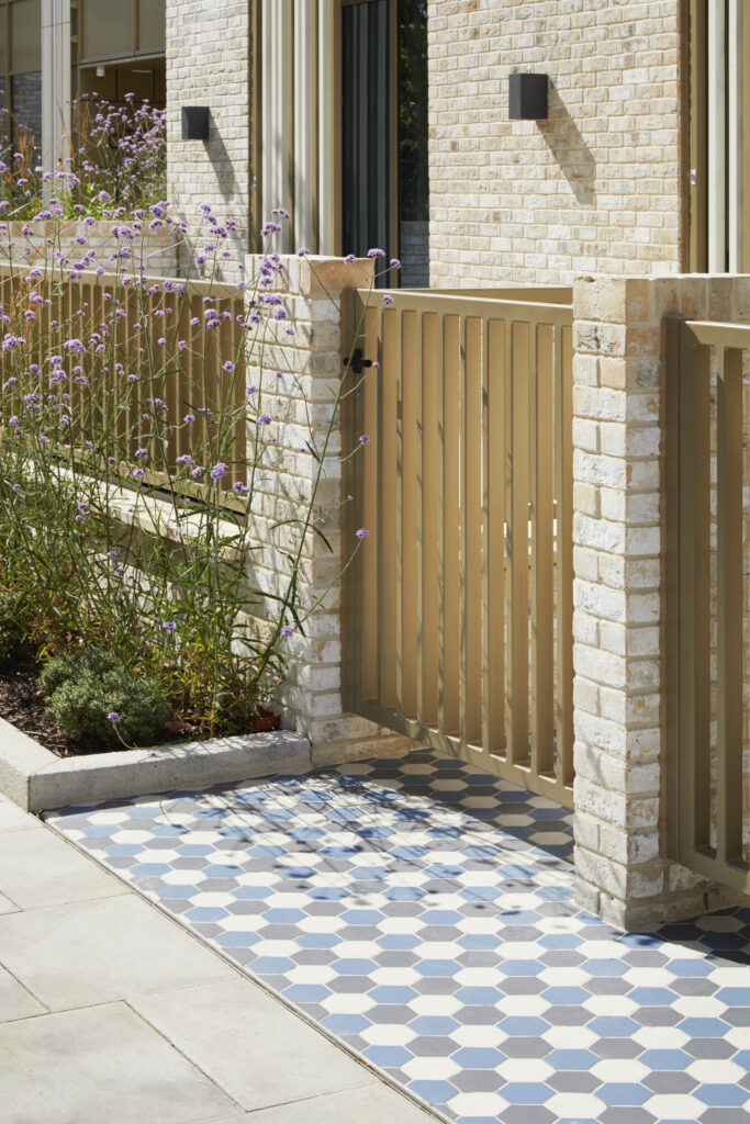
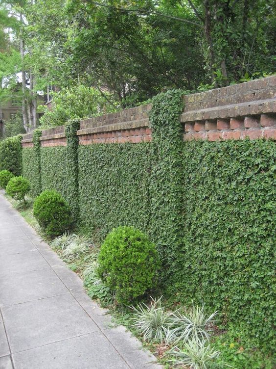
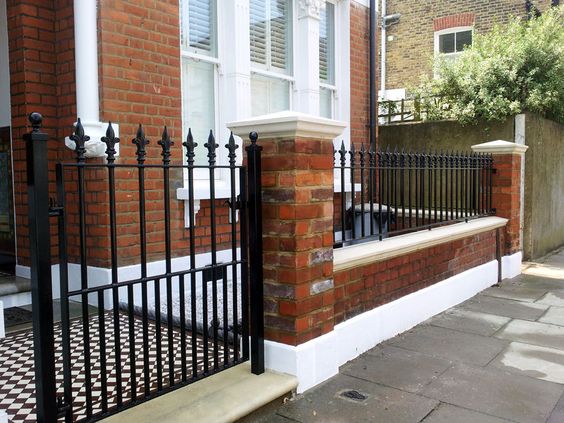
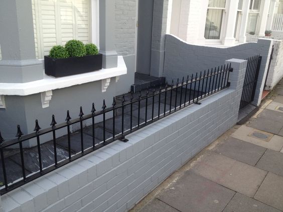
Boundary treatment – generally low stone or brick walls to road frontages with hedge planting behind.
StreetscapeStreetscape is a term used to describe the natural and built fabric of the street, and defined as the design quality of the street and its visual effect, particularly how the paved area is laid out and treated. It includes buildings, the street surface, and also the fixtures and fittings that facilitate its use – from bus shelters and signage to planting schemes. More patterns and street structure – consider the urban grainThe pattern of the arrangement of street blocks, plots and their buildings in a settlement. The degree to which an area’s pattern of blocks and plot subdivisions is respectively small and frequent (fine grain), or large and infrequent (coarse grain). Urban grain is a key component of defining the character of a place. More – generally medium sized houses in reasonably generous gardens, with larger buildings on the A56 corridor.