Trafford's Places
Rural Trafford
The rural areas of Trafford lie to the south west of the Borough and merge with the Cheshire countryside to the south. The extremities of Altrincham and its surroundings lie to the east and Carrington and Partington to the north. The canalised River Mersey clearly defines the western edge with the River Bollin forming the southern boundary of the Borough.
The area is notable for its well-preserved rural characterCharacter includes all of the elements that go to make a place, how it looks and feels, its geography and landscape, its noises and smells, activity, people and businesses. This character should be understood as a starting point for all development. Character can be understood at three levels; the area type in which the site sits, its surroundings and the features of the site. More and vernacular architecture, as well as a functioning agricultural industry. It also includes the regionally significant Dunham Massey Estate and deer park.
Settlements are dispersed, with groupings of dwellings that
notionally form the villages of Dunham Town, Dunham Woodhouses and Warburton, though these lack any formal centre and have limited local facilities. Within these settlements there are designated conservation areas covering part of each village.
Dunham Town is inextricably linked with the Dunham Estate, which was granted to the Massey family shortly after the Norman Conquest and is now run by the National Trust. Dunham Town historically provided accommodation for the Estate’s workers and tenant farmers. These ties have been maintained and are still evident in the uniform red detailsThe details of a building are the individual components and how they are put together. Some are a deliberate part of the appearance of a building, including doors, windows and their surrounds, porches, decorative features and ironmongery. Others are functional, although they can also contribute to the appearance of a building. These include lighting, flues and ventilation, gutters, pipes and other rainwater details. Detailing affects the appearance of a building or space and how it is experienced. It also affects how well it weathers and lasts over time. More (such as name signs, doors, fascias, soffits and rainwater goods) on National Trust owned Estate properties.
Several houses in Dunham Town date back to the eighteenth century when the house at Dunham Massey was rebuilt and the landscape remodelled. There was further development in the village in the latter part of the eighteenth century when Dunham School was built by Thomas Walton in 1759 and a public road bridge was constructed in the 1770s at the same time as the cutting of the Bridgewater Canal through the estate. New farmhouses and cottages within the area appear to date from this period. The area appears to have remained a hamlet until the eighteenth and early nineteenth century when red brick workers’ cottages were built as accommodation for employees of the Dunham Massey estate. The overall form and appearance of these cottages has generally changed very little.
Larger detached houses were constructed across the Dunham Massey estate from the early eighteenth to mid nineteenth century. These are still present in the Dunham Town Conservation Area.
The settlement of Dunham Woodhouses largely dates to the middle or latter part of the eighteenth century through to the nineteenth century. Buildings within Dunham Woodhouses are predominantly farmhouses and cottages and suggests that the settlement was originally established to provide additional houses for Dunham Massey estate labourers. The built environment of the area remains largely the same with the exception of the addition of some twentieth century agricultural buildings.
The medieval village of Warburton is considered to be one of the best-preserved historic landscapes in the area. Immediately south of the Red Brook there is evidence of a deer park including a substantial boundary bank (park pale). Several cruck framed structures have also been identified in the village. These buildings represent the earliest vernacular building traditions to survive in the area, and appear to date from fifteenth to seventeenth century. The second phase of timber construction is that of box framed construction with a transition to brick building during this period. All these earlier buildings were thatched, and where this has been removed, the roofs still retain the characteristic 42-degree angle.
Warburton has a long and continuous history both of settlement and working the surrounding land for agricultural purposes. Warburton is particularly notable for being both linked to, yet also remaining, distinctly unchanged by the industrialisation of Greater Manchester. The proximity of the Manchester Ship Canal brought this industrialisation close by but Warburton has remained distinctly rural and agricultural in characterCharacter includes all of the elements that go to make a place, how it looks and feels, its geography and landscape, its noises and smells, activity, people and businesses. This character should be understood as a starting point for all development. Character can be understood at three levels; the area type in which the site sits, its surroundings and the features of the site. More. This is evident in the number of farmhouses and former agricultural buildings within the Warburton Conservation Area and also the wider village. During the late nineteenth century there was a substantial period of rebuilding attributed to the investment by the Egerton – Warburton Estate. Much of this rebuilding was to a set style, designed by the notable architect John Douglas. This style emphasised the traditions of vernacular architecture, in particular, brick and tile mullion windows, terracotta detailingThe details of a building are the individual components and how they are put together. Some are a deliberate part of the appearance of a building, including doors, windows and their surrounds, porches, decorative features and ironmongery. Others are functional, although they can also contribute to the appearance of a building. These include lighting, flues and ventilation, gutters, pipes and other rainwater details. Detailing affects the appearance of a building or space and how it is experienced. It also affects how well it weathers and lasts over time. More such as finials and dog tooth brickwork, and projection shaped purlins to the roof. Following a decline in the number of farmsteads operating in the village the residential nature of the conservation area has intensified with the conversion of former farm buildings into additional dwellings.
The remainder of the area includes a scattering of farm buildings and associated isolated dwellings.
The remote nature of the area limits the capacity for significant sustainable development, although there is potential for exceptional and interesting responses to the vernacular architecture of the area. The area provides a significant green infrastructure resource for the Borough as an open and natural setting to enjoy while passing through or visiting local attractions.
Development Plan Documents
Warburton
Dunham Town
Dunham Woodhouses
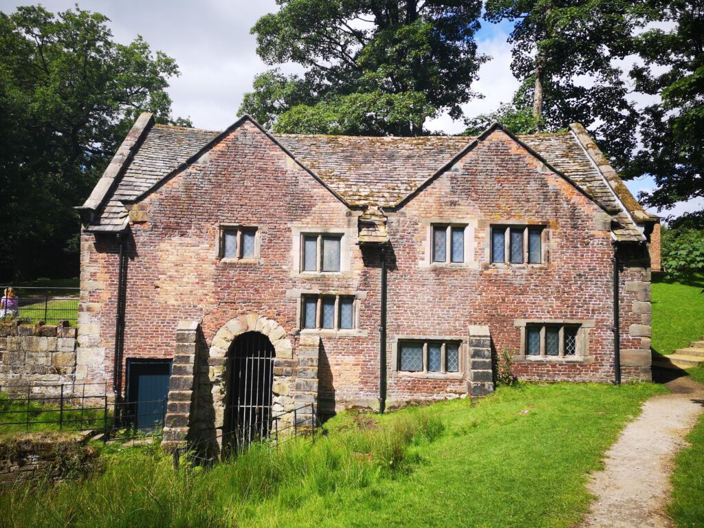
Water Mill, Dunham Hall
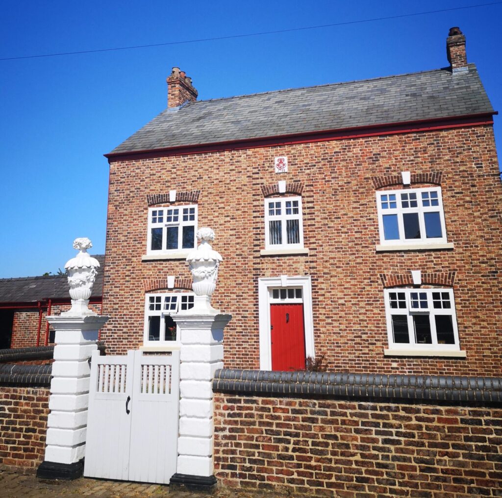
Village Farmhouse, Dunham Woodhouses
Evolution
Local Character Areas
The parish of Warburton occupies the most westerly part of the Borough. It is agricultural in characterCharacter includes all of the elements that go to make a place, how it looks and feels, its geography and landscape, its noises and smells, activity, people and businesses. This character should be understood as a starting point for all development. Character can be understood at three levels; the area type in which the site sits, its surroundings and the features of the site. More and includes the village of Warburton along with hamlets and linear settlements that house the small resident population. It is notable for a number of buildings by the Victorian architect John Douglas.
The parish of Dunham Massey includes the villages of Sinderland Green, Dunham Woodhouses and Dunham Town as well as a number of pubs and local attractions. Like Warburton, the area has largely avoided development since the 19th century.
Dunham Park is part of the Dunham Massey parish, which is distinct for its walled estate which contains the Grade I listed Dunham Hall, Carriage House and Stables and the Grade II* listed Watermill, Gardens and Deer Park that is a popular destination for visitors across the region. It has a visitor centre and cafe, one of the few modern buildings in the area.
The Bridgewater Canal corridor ends its route in Trafford as it passes through the area linking the Trafford conurbation to the countryside as well as surrounding towns such as Lymm.
The former railway between Altrincham and Warrington also provides a key strategic leisure route between Altrincham and the rural areas. It forms part of the Trans Pennine Trail, running from Liverpool to Hull.
The Manchester Ship Canal is merged with the River Mersey for this section and is a significant heritage assetA building, monument, site, place, area or landscape identified as having a degree of significance meriting consideration in planning decisions, because of its heritage interest. It includes designated heritage assets and assets identified by the local planning authority (including local listing). More that also provides a leisure opportunity and important habitats for flora and fauna.
Place Specific Design Cues
Context dependent design cues should be taken from the best examples of the traditional properties in the area.
Please refer to the Common Housing Types in Trafford link for guidance on how to understand context and also the Warburton Village Design Statement. This includes a number of the cues set out below. Characteristics commonly found in Rural Trafford are set out below:
Notable buildings and landmarks – consider how these might inform new design.
Built FormForm is the three-dimensional shape and modelling of buildings and the spaces they define. Buildings and spaces can take many forms, depending upon their: size and shape in plan; height; bulk – their volume; massing – how bulk is shaped into a form; building lines – the alignment of building frontages along a street; and relationship to the plot boundary – and whether they share party walls or not. In the case of spaces, their form is influenced by the buildings around them. More, Height, Roofscape – generally two-storey with pitched roofs.
Local building materials – almost exclusively handmade Cheshire commons, often Estate burnt, in English Garden Wall or Flemish bond with sandstone detailingThe details of a building are the individual components and how they are put together. Some are a deliberate part of the appearance of a building, including doors, windows and their surrounds, porches, decorative features and ironmongery. Others are functional, although they can also contribute to the appearance of a building. These include lighting, flues and ventilation, gutters, pipes and other rainwater details. Detailing affects the appearance of a building or space and how it is experienced. It also affects how well it weathers and lasts over time. More or red stock dressings. There are a small number of cruck and timber framed buildings focused around Warburton. Roofs are typically clad in blue slate with decorative ridge tiles; there are smaller numbers of red clay tiled roofs. Thatched roofs are present on some of the historic buildings in Rural Trafford. Windows are typically painted timber, three light multi-paned, sometimes with brick mullions. Doors are also painted timber, often vertically boarded with traditional black metal door furniture.
Façade composition – modestly proportioned elevations, with horizontally proportioned sliding sash or casement windows in older properties and vertically proportioned sash windows in later properties.
Architectural detailingThe details of a building are the individual components and how they are put together. Some are a deliberate part of the appearance of a building, including doors, windows and their surrounds, porches, decorative features and ironmongery. Others are functional, although they can also contribute to the appearance of a building. These include lighting, flues and ventilation, gutters, pipes and other rainwater details. Detailing affects the appearance of a building or space and how it is experienced. It also affects how well it weathers and lasts over time. More – farmhouses and cottages are modest in appearance with simple detailingThe details of a building are the individual components and how they are put together. Some are a deliberate part of the appearance of a building, including doors, windows and their surrounds, porches, decorative features and ironmongery. Others are functional, although they can also contribute to the appearance of a building. These include lighting, flues and ventilation, gutters, pipes and other rainwater details. Detailing affects the appearance of a building or space and how it is experienced. It also affects how well it weathers and lasts over time. More around windows typically comprising stone cills and arched or cambered soldier brick headers. Arched or cambered soldier brick headers are typically used above doors. In Warburton Conservation Area, the architecture typically follows a distinct local vernacular which combines the detailingThe details of a building are the individual components and how they are put together. Some are a deliberate part of the appearance of a building, including doors, windows and their surrounds, porches, decorative features and ironmongery. Others are functional, although they can also contribute to the appearance of a building. These include lighting, flues and ventilation, gutters, pipes and other rainwater details. Detailing affects the appearance of a building or space and how it is experienced. It also affects how well it weathers and lasts over time. More of the Arts and Crafts style with a local characteristic for two-storey buildings, the upper Trafford Design Code Trafford’s storey of which is set high up under the pitched roof with large gable dormers. A number of buildings were designed by renowned architect John Douglas.
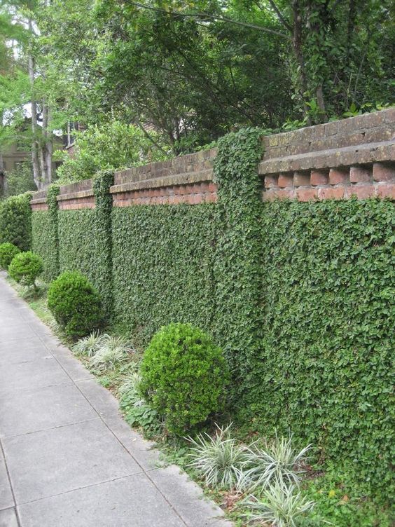
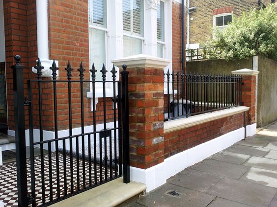
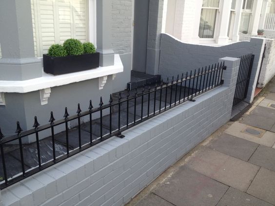
Boundary treatment – hedges and planting, Cheshire railings, chestnut paling, supplemented with planting. There is evidence of low brick boundary walls with stone or blue clay copings in Dunham Town and Dunham Woodhouses. The use of upright locally-quarried flagstones is characteristic of the boundary treatments throughout the Warburton Conservation Area.
StreetscapeStreetscape is a term used to describe the natural and built fabric of the street, and defined as the design quality of the street and its visual effect, particularly how the paved area is laid out and treated. It includes buildings, the street surface, and also the fixtures and fittings that facilitate its use – from bus shelters and signage to planting schemes. More patterns and street structure – consider the urban grainThe pattern of the arrangement of street blocks, plots and their buildings in a settlement. The degree to which an area’s pattern of blocks and plot subdivisions is respectively small and frequent (fine grain), or large and infrequent (coarse grain). Urban grain is a key component of defining the character of a place. More – generally a mix of small and medium sized houses in average sized gardens. Dwellings are typically informally clustered or reflect a farmstead layout.

