Trafford Wharfside
Plot 10a
Plot Boundary
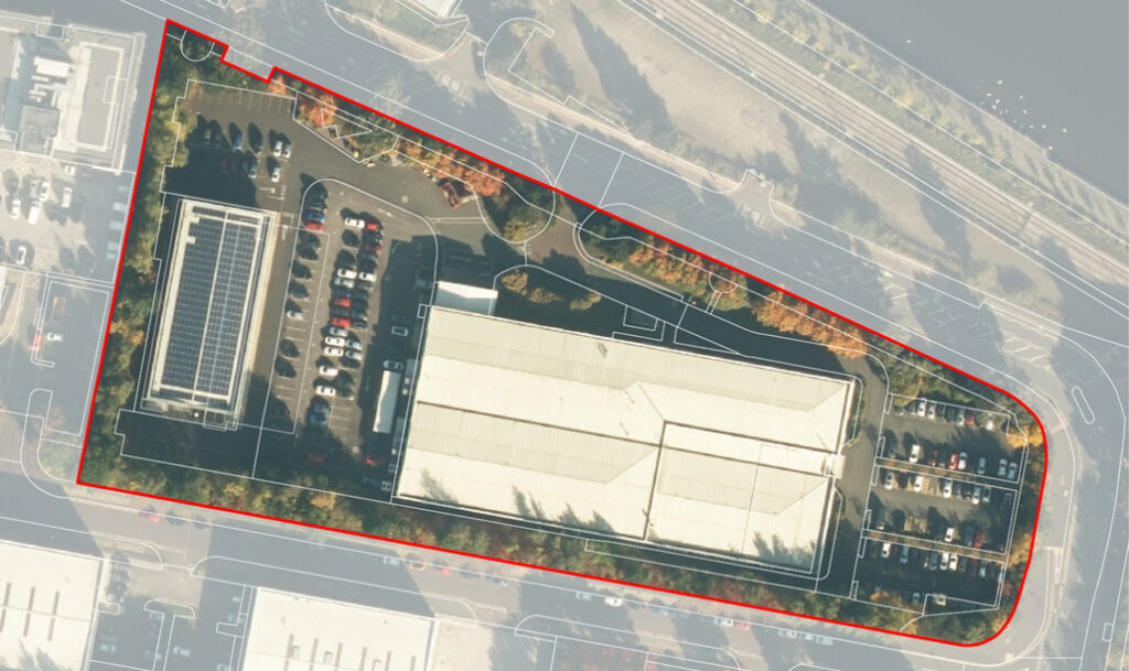
Indicative massing model in context
Plot Parameters
Land Use
Character Area
The designated land use to create necessary character, activity, employment spaces and housing
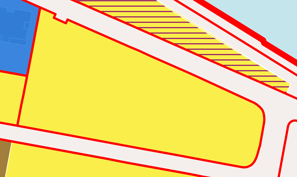

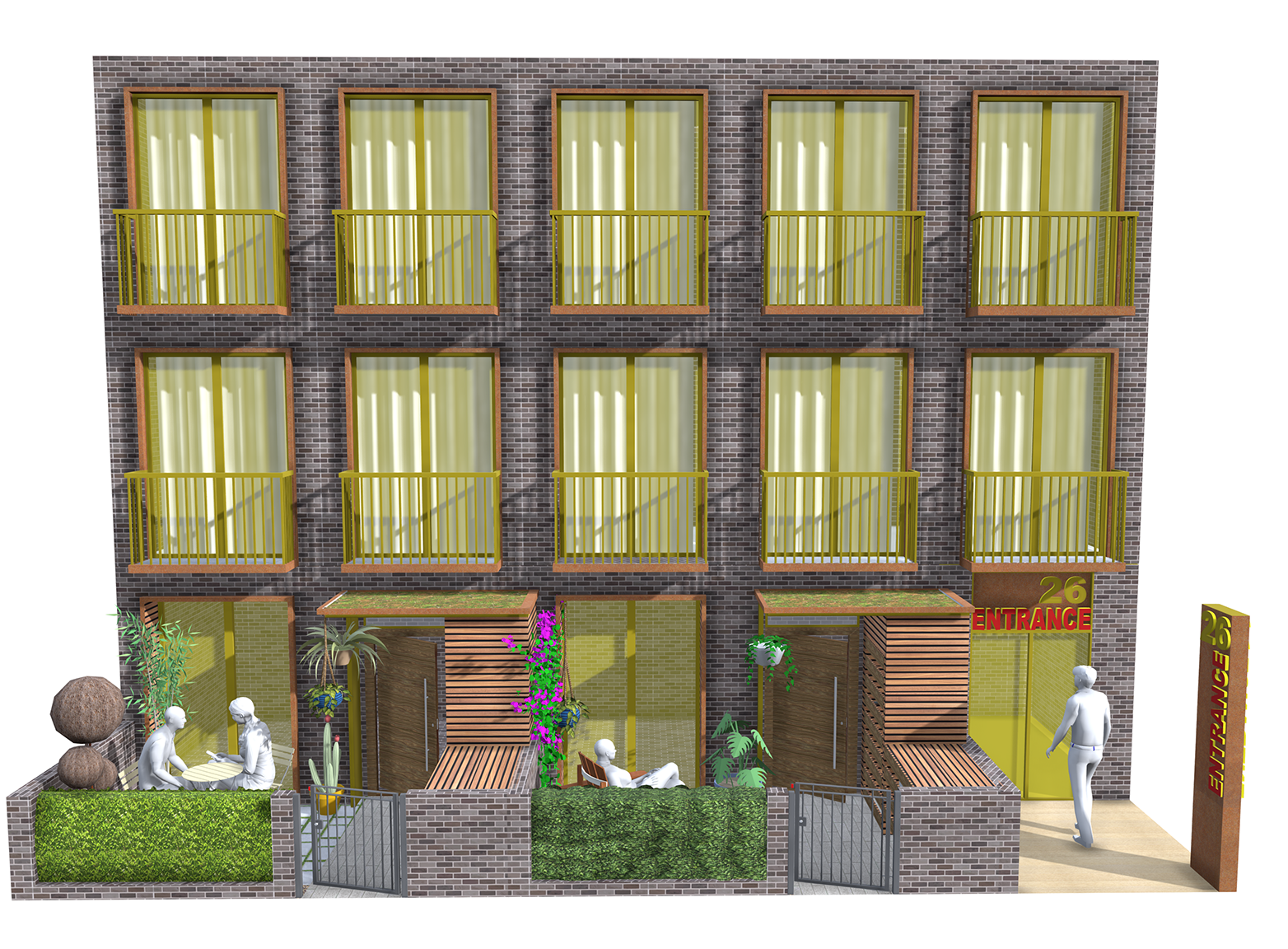
Predominantly residential with either active commercial uses or private residential entrances on ground floors
Fixed Parameters
Mandatory requirements for new access streets, tree protection, adequate separation distances and new public spaces. Requirements in relation to streets and public realm are fixed unless an applicant can demonstrate that a plot can be successfully developed with an alternative route or space within the plot which delivers the same amenity, accessibility and permeability benefits.
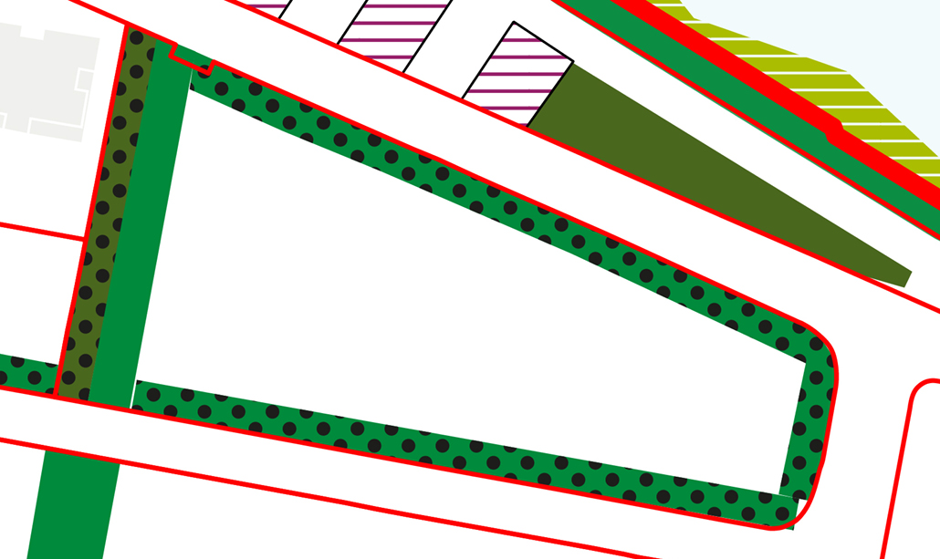

New streets or pedestrian public realm spaces required for access
Dedicated public or privately owned open spaces used for parks, urban squares and play spaces
All trees to be surveyed and protected when necessary and possible
Zone where tall buildings can be placed without overshading, overbearing or overlooking neighbouring buildings and spaces
Plot Layout
Target plot coverages ensure an appropriate balance between buildings, streets and public open spaces within plots.
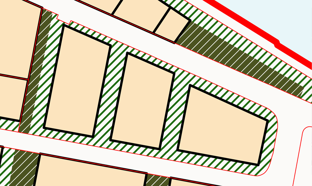
An indicative layout, demonstrating how the plot coverages can be achieved
This is the proportion of the total plot area allocated for streets or public spaces, with the remaining being development land for buildings and private spaces.
It is important to provide a liveable balance between building plots and public open spaces, in form of parks or streets. In such an urban environment, a permeable network of streets and open spaces are expected for people to travel through the area and spend time enjoying green spaces. These public spaces may be on private land.
Developable Land: 60%
Streets and Public Realm: 35%
Public Open Space: 5%
Density
Density targets ensure that amenities and quality of life are not impacted by overdevelopment
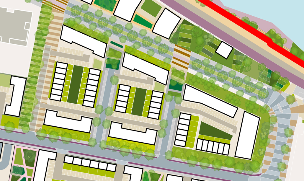
An indicative layout, demonstrating how the target densities can be achieved
Approximate Examples
Residential units: 394*
(37 Houses / 357 Apartments)
Dwellings per hectare (net): 201dph
Total people: 1,267
People per hectare (net): 645pph
Apartment GIA
- 70% GIA vs GFA
Apartment mix
- 1 bedroom = 30%
- 2 bedroom = 50%
- 3 bedroom = 15%
- 4 bedroom = 5%
Apartment size
- 1 bedroom = 58sqm
- 2 bedroom = 79sqm
- 3 bedroom = 108sqm
- 4 bedroom = 130sqm
Block Types
The types of block recommended for this plot to create appropriate balance between urban densities and family living
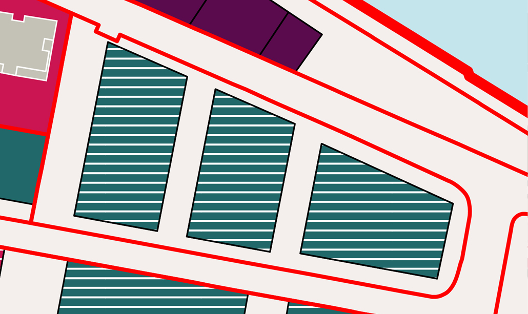
An indicative layout, demonstrating how the block types can be achieved


A block shared by apartments and houses with mix of private gardens and communal spaces.
Block Layouts
Block layout zones ensure sustainable urban forms, density, minimum private open spaces and protect views/outlook
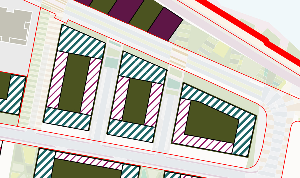
An indicative layout, demonstrating how buildings should be placed. NB: gaps between buildings on each elevation are expected
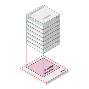
The target block coverage percentages are the proportion of the block area occupied by buildings. It can be calculated by dividing the building footprint by the total block area.
Block coverage targets are used to achieve the right balance between density and the livability of a block. Essentially, it sets a minimum standard for private open spaces for inhabitants of those buildins. Similar density levels can be achieved with different block coverages. Larger building coverage can achieve lower building heights but less private open space. Lower building coverage provides more outdoor space for gardens or private parking, but taller buildings. A balance needs to be achieved to ensure adequate private open spaces are provided for the level of density on each plot.


Houses: 20%
Apartments: 40%
Private open space: 40%
Building Types
The building types that are appropriate to ensure an appropriate mix of residential or commercial types
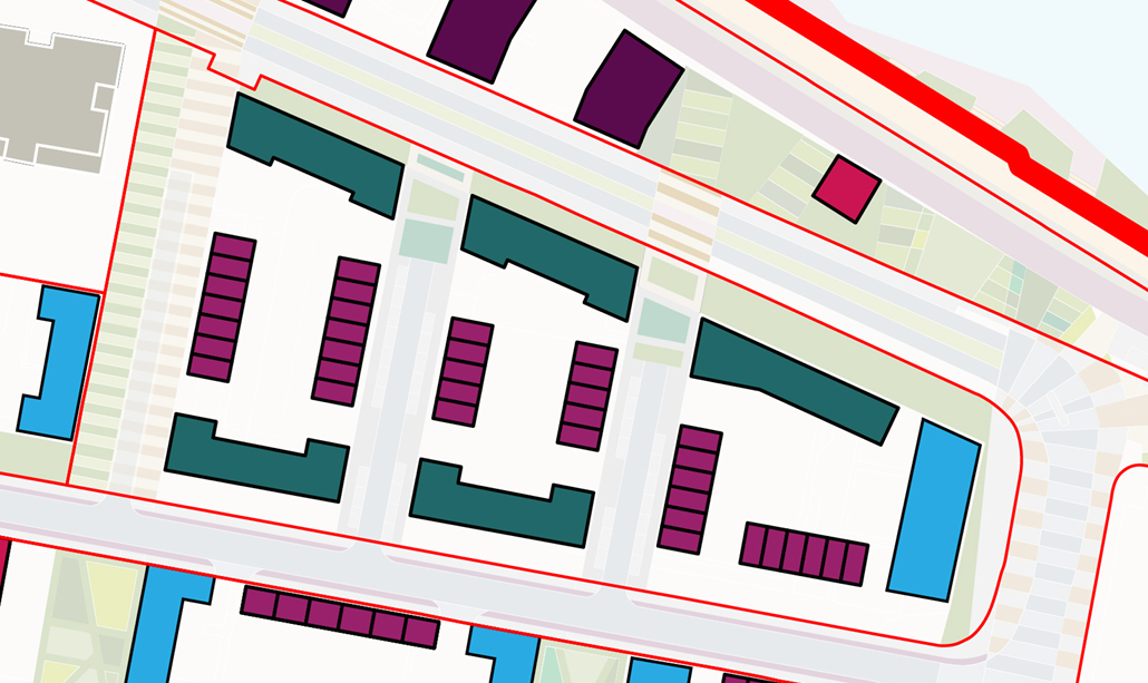
An indicative layout, showing mix of different building types possible within plot


- Private entrance on street
- Single family homes or maisonettes with both private entrances from street
- Private rear gardens
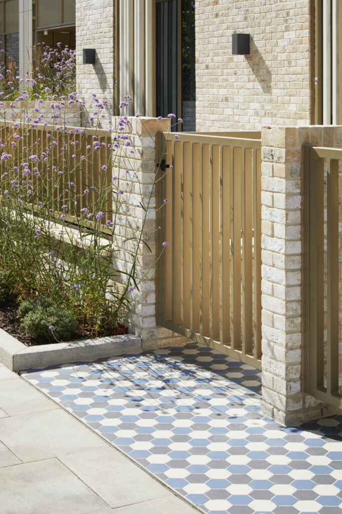
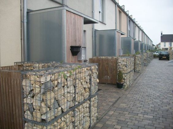
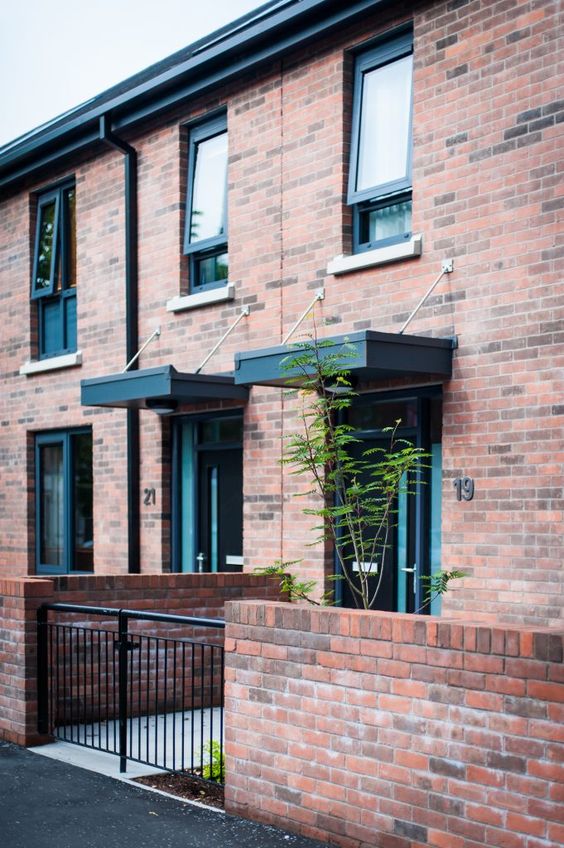
- Set back from street with small front gardens and bin storage
- Apartments with openable windows on at least 2 elevations
- Suitable on all orientations
- Private residential entrances or commercial uses on ground floors
- Top floors can be set back for roof terraces
- Interesting roof forms required
- Apartments with openable windows on only one elevation
- Suitable only on east/west facing edges
- Private residential entrances or commercial uses on ground floors
- Top floors can be set back for roof terraces
- Interesting roof forms required
Building Massing
The target floor area ratio ensures that massing of buildings is appropriate for plot size/type, character and location
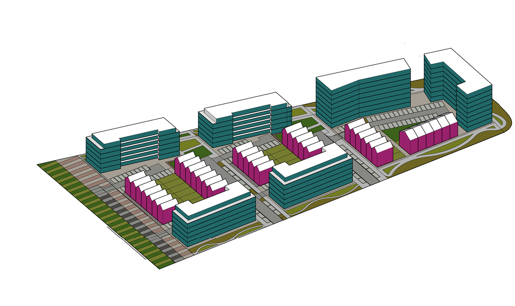
An indicative massing model, showing building scale and mass of buildings
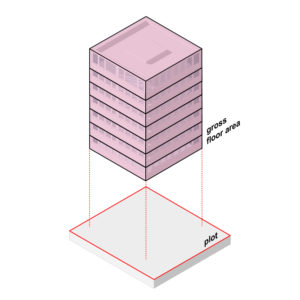
Floor area ratio is the percentage between the total plot area and the total building floor area. It is calculated by dividing the total gross floor area of the building by the area of the plot. Plots with taller buildings will generally have higher floor area ratios.
Floor area ratios are simple metrics to control the massing of development plots. When combined with building footprint coverage targets, FAR targets can ensure plots are not overly developed and there is sufficient private open space to support higher density buildings.
Gross floor area (or gross external area GEA) can be 2 x plot area
Building Heights
Building heights used to create skyline whilst protecting the amenity, overlooking and overshadowing of neighbours
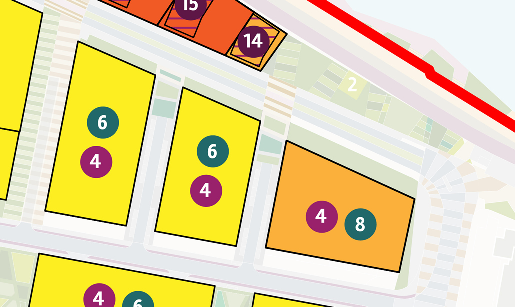
Diagram shows building heights in stories.
Houses
Apartments
Active edges
The active uses required on building ground floors to create active, overlooked and interesting spaces around blocks
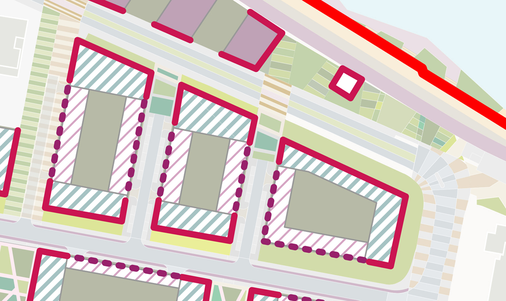
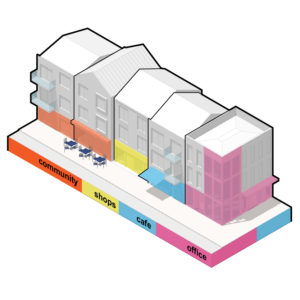
A balance needs to be achieved between different ground floor uses to ensure public realm stays active and overlooked for long periods of day. The type of uses required depend on location within the master plan and can either be residential entrances or active commercial uses.
General target:
- frequent doors and windows, with few blank walls;
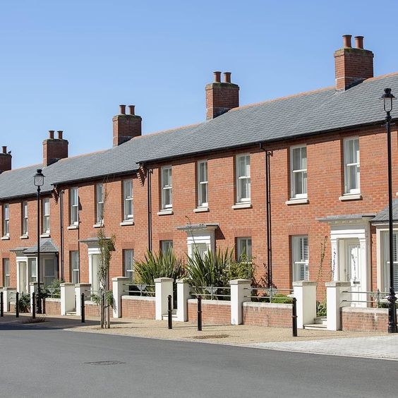
- Ground floor residential entrances with small outdoor gardens;
- numerous building entrances and lobbies directly from public streets;
- narrow frontage buildings, giving vertical rhythm to the street scene;
- lively internal uses visible from the outside, or spilling onto the street.
Making frontages ‘active’ adds interest, life and vitality to the public realm. Active fronts also provide informal surveillance opportunities, improving the safety of an area and creating vitality through the presence and interaction of people.


Commercial uses or private residential entrances
Private residential entrances
Active edge types
Retail and leisure: shops and cafes create lots of people activity, primarily during the day. They can be great places for the community to meet or have a coffee. Outdoor seating for cafes is encouraged. 
Offices and workshops: work spaces with windows and entrances from street will create long periods of activity during the day. Entrances should always be taken from the public realm.
Cafes, restaurants and bars: will create activity during the evening time. Outdoor seating and large windows can deliver activity to enliven streets when permissible. 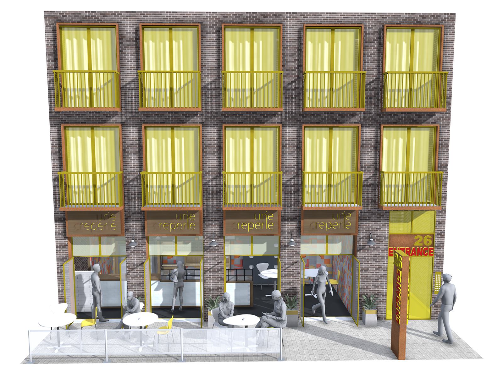
Residential windows and entrances: ground floor apartments or houses can provide activity during day and night and encourage stewardship by residents over the public realm.
